Shyala
Table of Contents
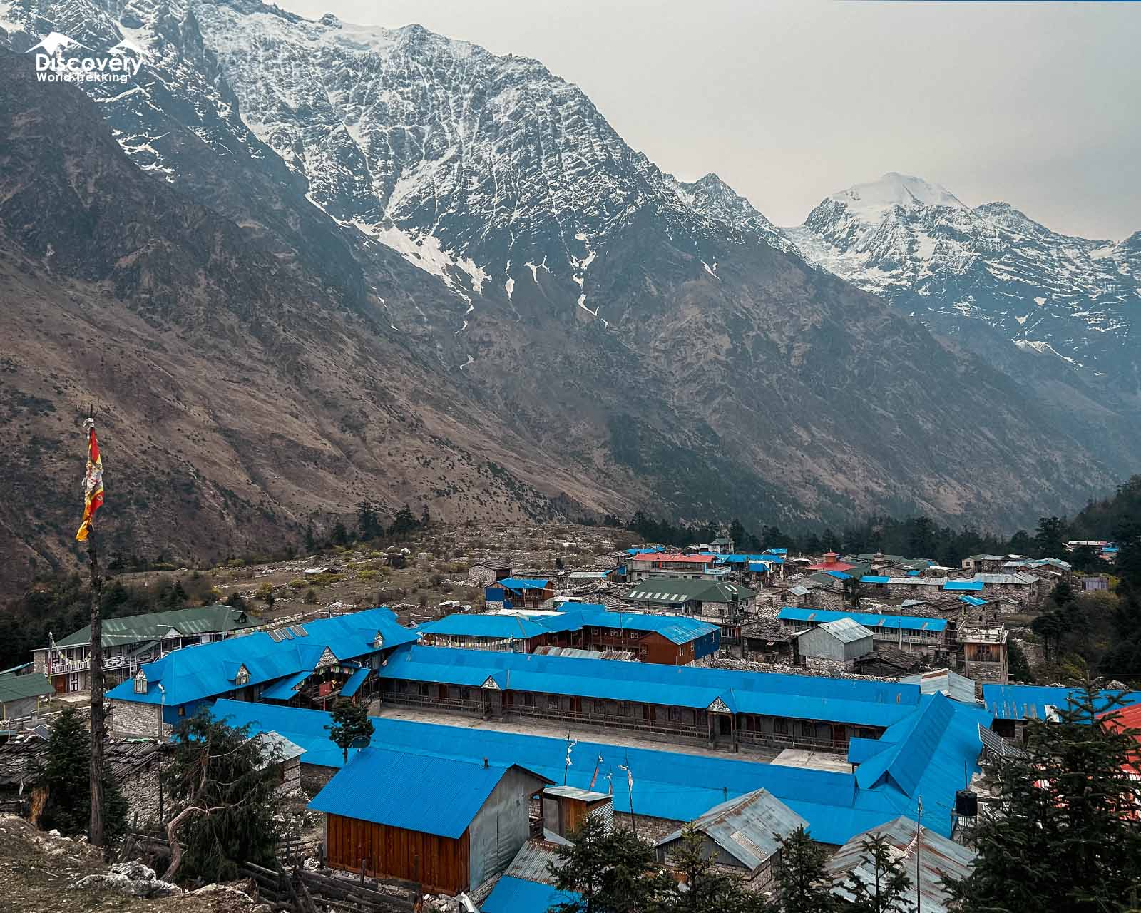
Shyala is a quiet Tibetan Buddhist village on the Manaslu Circuit Trek where the dark pine forests of the lower valley open suddenly into a wide, sunlit glacial plateau.
Unlike its busier neighbours, Lho and Samagaun, Shyala feels unhurried and open, consisting of a small collection of flat-roofed stone houses, yak pastures, and family-run teahouses surrounded by snow-covered peaks on every horizon.
Where Is Shyala Located?
Shyala lies in the upper Nubri Valley of Gorkha District, inside the Manaslu Conservation Area. It sits on the Manaslu Circuit between Lho (3,180 m) to the south-east and Samagaun (3,530 m) to the north-west.
The village stands about 3.5–4 km beyond Lho and about 3.5 km before Samagaun by trail. Pungyen Gompa lies around 6 km away up a side valley towards the south face of Manaslu.
|
Country |
Nepal |
|
Province |
Gandaki Province |
|
District |
Gorkha |
|
Municipality |
Tsum Nubri Rural Municipality |
|
Region |
Upper Nubri Valley, Manaslu region |
|
Protected area |
Manaslu Conservation Area |
|
Latitude |
Approximately 28.57° N |
|
Longitude |
Approximately 84.67° E |
|
Elevation |
3,500 m (11,482 ft) |
|
Distance from Lho |
About 3.5–4 km by trail |
|
Distance to Samagaun |
About 3.5 km by trail |
What Is Shyala Known For?
Shyala is known for its sweeping, close-up views of Manaslu, its calm teahouses away from the busier villages, and its Tibetan Buddhist way of life. It is also the starting point for the side trip to Pungyen Gompa.
1. A Wide Glacial Valley Facing Mount Manaslu
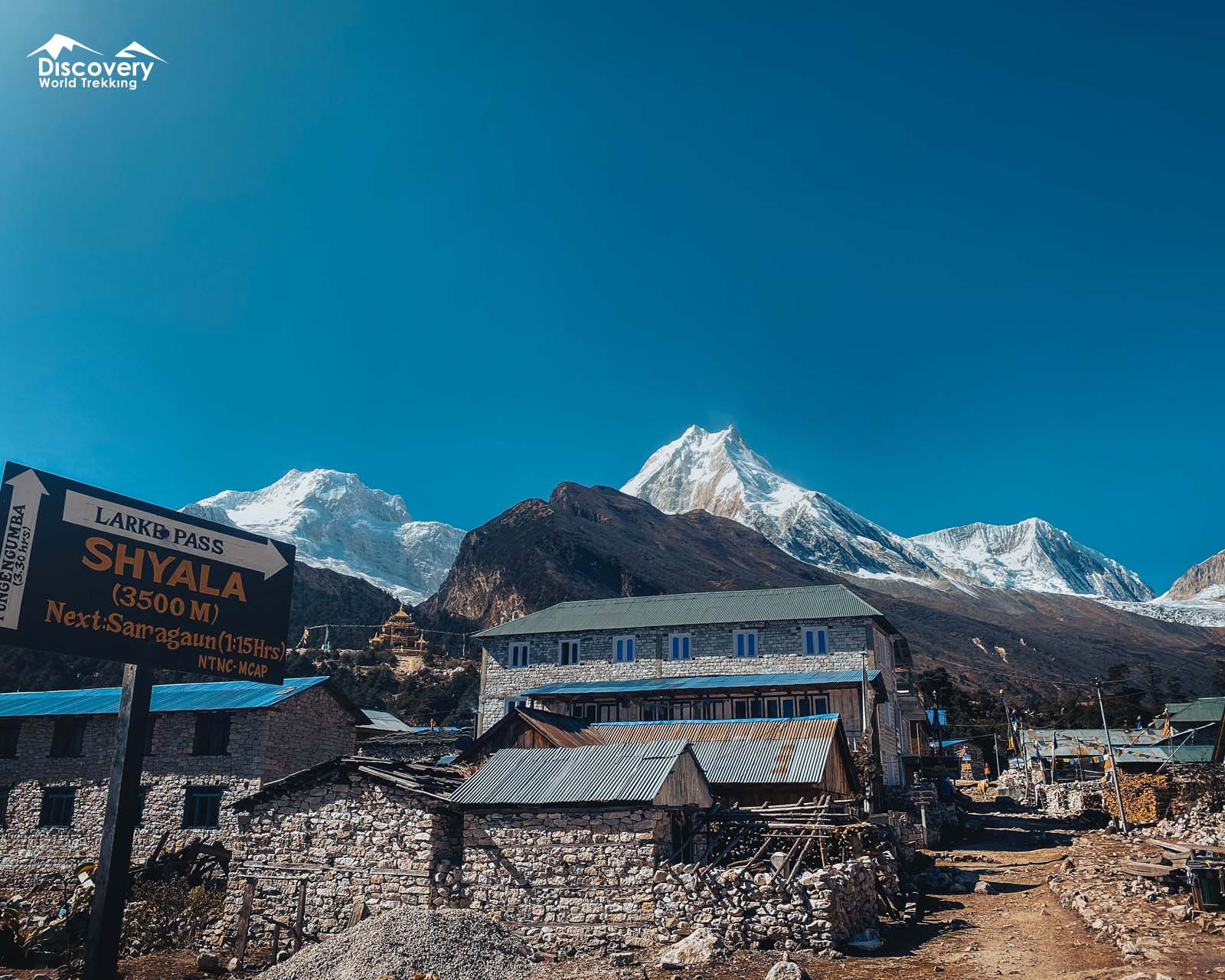
Shyala occupies a broad, open basin that acts as a natural viewing platform for an eight-thousander and several towering seven-thousanders.
Looking ahead and around the village, you get uninterrupted, eye-level views of Mount Manaslu (8,163 m)—the world's eighth-highest peak—alongside Manaslu North (7,157 m), Ngadi Chuli / Peak 29 (7,871 m), Himalchuli (7,893 m), Naike Peak (6,211 m), and the distant Ganesh Himal range to the east.
2. A Quiet Overnight Stop Between Lho and Samagaun
On the Manaslu Circuit, Shyala serves as the calm middle ground between Lho (3,180 m) and Samagaun (3,530 m).
Trekkers who start their morning in Namrung (2,660 m) often walk past Lho to spend the night in Shyala at 3,500 m, breaking up the ascent and leaving an easy one-hour morning stroll into Samagaun the next day.
3. A Quieter Alternative to Samagaun for Mountain Views
Although Samagaun is the largest village in the Nubri Valley, its location close to the northern ridge partially blocks direct views of Manaslu's main summit from the village centre.
Shyala sits further back in the open centre of the valley, giving you a cleaner, wider angle of the entire Manaslu massif without the busier lodge traffic of Samagaun.
4. A Tibetan Buddhist Village in the Upper Nubri Valley
Shyala belongs to the culturally Tibetan Nubri region, where daily life revolves around highland farming, yak herding, and Nyingma Buddhist traditions.
Long stone mani walls, whitewashed chortens, a quiet village gompa, and traditional wood-and-stone homes give the village an authentic trans-Himalayan character.
5. The Gateway to Pungyen Gompa
Shyala is the closest village on the main trail to Pungyen Gompa (about 4,000 m). The monastery sits on an alpine plateau beneath the south face of Manaslu. Many trekkers visit it from Shyala, then continue to Samagaun on the same day.
How to Reach Shyala?
Shyala has no road or flight access and can only be reached on foot as part of the Manaslu Circuit Trek.
The journey begins with an overland drive from Kathmandu to the roadhead at Machha Khola in the Budhi Gandaki valley, followed by five to six days of trekking north through Jagat, Deng, and Namrung.
By Road and On Foot: Standard Manaslu Circuit Route
Route: Kathmandu → Dhading Besi / Mugling → Arughat → Soti Khola → Lapubesi → Machha Khola → Jagat → Deng → Ghap → Namrung → Lihi → Sho → Lho → Shyala
The journey starts with an 8- to 9-hour drive (160 km) by bus or private jeep from Kathmandu via Arughat and Soti Khola to the trekking trailhead at Machha Khola (890 m).
From Machha Khola, the multi-day walk follows the Budhi Gandaki River north:
- Machha Khola to Doban (1,070 m) and Philim (1,570 m) / Jagat (1,410 m): Walk 9.5 km (4 to 5 hours) to Doban on the first trekking day, then continue 13 km (5 to 6 hours) via Jagat to Philim, where permits are checked.
- Philim to Deng (1,860 m): Walk 11 km in 5 to 6 hours through narrow gorges and pine forests to Deng.
- Deng to Ghap (2,250 m) and Namrung (2,660 m): Continue 11.5 km (5 to 6 hours) via Rana and Bihi Phedi to Ghap, and ascend 9 km (4 to 5 hours) through bamboo and rhododendron forest into Namrung (on faster 12-day itineraries, Deng to Namrung is covered in a single 6 to 7-hour, 18.2 km day).
Final Approach: Namrung and Lho to Shyala
Route: Namrung → Banjam → Lihi → Sho → Lho → Pungyen Khola → Shyala
From Namrung (2,660 m), the trail enters the Upper Nubri valley, ascending gently past stone kani gates and barley fields through Lihi (2,920 m) and Sho (2,960 m) to reach Lho (3,180 m) after 11 km (4 to 5 hours).
From Lho, the final stretch to Shyala covers 3.5 to 4 km and takes 1.5 to 2 hours:
- Leave Upper Lho past Ribung Monastery and descend briefly through pine woods to cross a wooden bridge over the glacier-fed Pungyen Khola (Numla Khola).
- Follow the steady uphill forest trail through silver fir, birch, and rhododendron trees as the valley widens.
- Ascend the final stone-lined path onto the open terrace to reach Shyala (3,500 m).
Altogether, walking directly from Namrung to Shyala covers 14 km and takes around 6 to 7 hours.
Alternative Approach via the Tsum Valley
Route: Lokpa → Chumling → Chhokangparo → Nile → Mu Gompa → Lokpa → Deng → Namrung → Lho → Shyala
Trekkers on the combined Manaslu Tsum Valley Trek turn east just above Philim to spend five to six days exploring Chumling, Chhokangparo, and Mu Gompa in the sacred Tsum Valley.
After returning to the main Budhi Gandaki trail near Lokpa and Deng, the route follows the exact same path through Namrung and Lho up to Shyala.
Onward Trail: From Shyala to Samagaun
Route: Shyala → Pungyen Khola Bridge → Samagaun
Leaving Shyala (3,500 m), the onward walk to Samagaun (3,530 m) is one of the easiest and most scenic stretches on the entire circuit.
The path crosses a suspension bridge over the tributary draining the Pungyen Glacier and follows a wide, nearly flat yak meadow for 3.5 to 4 km (taking 1 to 1.5 hours, with just 30 metres of net elevation gain) into Samagaun.
What to See and Do in Shyala?
Shyala is small, but it is one of the most rewarding places on the Manaslu Circuit to slow down. Most of what you will want to do here sits within an easy walk of the lodges.
1. Hike to Shyala Ridge Flagpoint for Sunrise
A prayer-flag ridge above the village makes the best sunrise viewpoint in Shyala. The walk takes about 45 minutes and gains roughly 150 m. Leave in the dark with a headtorch to reach the top before first light.
At sunrise, the light reaches Manaslu's summit first, then slides down across its glacier and ridges. Himalchuli and Ngadi Chuli turn pink soon after.
2. Watch Sunset Over Manaslu, Himalchuli and Ngadi Chuli
Because Shyala sits on a flat terrace in the middle of the valley, it is one of the few villages on the circuit where both sunrise and sunset hit the surrounding peaks cleanly.
No hiking is required; right from your teahouse courtyard or the village edge, you can watch late-afternoon alpenglow turn the icy eastern walls of Manaslu (8,163 m), Ngadi Chuli (7,871 m), and Himalchuli (7,893 m) from white to deep amber and pink before the night stars appear.
3. Visit Shyala Village Gompa
Tucked peacefully among the stone homes, the Shyala Village Gompa (alongside the nearby HangSangfu meditation retreat, a 20 to 30-minute, 600-metre walk east of the village) serves as the spiritual anchor for local Nubri families.
Unlike large tourist monasteries, this modest Nyingma shrine is quiet and intimate, featuring traditional Tibetan murals, statues of Guru Rinpoche, and butter lamps lit by village elders and yak herders.
4. Explore Mani Walls, Chortens and Prayer Flags
Walking the stone-paved village path through Shyala takes 20 to 30 minutes (around 1 km) and passes long mani walls built from thousands of hand-carved slate tablets bearing the mantra Om Mani Padme Hum.
Traditional whitewashed Buddhist chortens and tall prayer flag poles (darchog) mark the entrances to the plateau, framing classic photography angles with Mount Manaslu directly behind them.
5. Walk Through the Yak Pastures and Shyala Khola
Wide alpine meadows surround Shyala on all sides, bordered by the clear, icy waters of the Shyala Khola and Numla Khola glacial streams.
A gentle 2 to 3 km stroll (1 to 1.5 hours) across the flat grazing fields lets you watch shaggy yaks and dzopkyos (yak-cattle hybrids) grazing beneath the glaciers while giving your legs an easy active-recovery walk at 3,500 metres.
Give grazing animals plenty of space and never walk between a yak and its calf. Stay on existing paths so you do not damage the fields.
Side Trips from Shyala
Shyala's location between Lho and Samagaun makes it an ideal base for half-day acclimatisation hikes into the surrounding glacial basins before you head higher toward Samdo and Larkya La Pass.
1. Pungyen Gompa via Green Lake and Puggen Tal
Sitting at 4,000 m to 4,040 m on a dramatic grassy amphitheatre directly beneath the south face of Mount Manaslu and the Pungyen Glacier, Pungyen Gompa is the most rewarding half-day hike from Shyala.
Because the trail branches off the main circuit right between Shyala and Samagaun, Pungyen Gompa is actually closer to Shyala than to Samagaun.
Distance & Time
Approximately 10 to 11.4 km round trip (around 5 to 6 km each way), taking 3.5 to 5 hours total with an elevation gain of roughly 500 to 540 metres. (Alternatively, you can hike up from Shyala in 2.5 to 3 hours and descend directly to Samagaun in 1.5 to 2 hours).
Trail Highlights:
The path follows the milky glacial waters of the Numla Khola (Pungyen Khola) uphill past yak pastures and small seasonal meltwater ponds known locally as Puggen Tal (Green Lake) before emerging onto the high plateau where the 400-year-old monastery faces the icefalls of Manaslu and Peak 29.
2. Birendra Lake via the Pungyen Glacier Moraine
Birendra Lake (Birendra Tal, 3,450 m to 3,690 m) is a striking turquoise freshwater lake fed directly by the Manaslu (Pungyen) Glacier just west of Samagaun.
Named after the late King Birendra of Nepal, the lake reflects the surrounding ice walls on calm mornings.
Distance & Time
From Shyala, you walk 3.5 km (1 to 1.5 hours) across the flat meadow trail toward Samagaun, then branch west across the glacial moraine and stream bridge for another 1.5 to 2 km (45 minutes to 1 hour).
The full return excursion from Shyala covers 9 to 10 km round trip and takes 3 to 4 hours inside a single day.
3. Ribung Gompa in Lho
If you arrived in Lho late the previous afternoon or missed its monastery in the afternoon clouds, you can easily hike back down to Ribung Gompa (Lho Monastery, around 3,250 m) from Shyala.
Distance & Time
Located 3 to 3.5 km southeast of Shyala, taking 1 hour going down and 1.5 hours walking back up (2.5 hours round trip).
Trail Highlights
Ribung Gompa is the largest monastery in Lho, home to young novice monks and famous for the iconic view where its ornate Buddhist gate and golden roof frame the twin peaks of Mount Manaslu.
4. Dang Manang Valley
Located a few kilometres north of Shyala in the upper Gorkha district (not to be confused with the Manang valley on the Annapurna side), Dang Manang is a quiet, untouched side valley known for its wide yak pastures, deep river gorges, and raw glacial scenery.
Distance & Time
Approximately 8 to 12 km round trip, taking 5 to 7 hours as a full-day hike, or 1 to 2 days if done as an overnight camping trip.
Trail Highlights
Walking into Dang Manang takes you completely off the main circuit trail into open summer grazing meadows where local Nubri herders bring their yaks.
Along the way, you get close-up views of hanging glaciers, dramatic rock canyons (Gahiro Galchhi), and high ridges where blue sheep and Himalayan tahr often graze. Because the path follows quiet herder tracks across rocky glacial terrain, it is best explored on a clear day with your guide.
Popular Treks Passing Shyala
These treks pass through or stay in Shyala on the way to Samagaun.
|
Trek |
Shyala on the route |
|
Passes through Shyala on the 7.2 km walk from Lho to Samagaun, with views of Himalchuli, Ngadi Chuli and Manaslu. | |
|
Spends a night in Shyala after the long day from Namrung, then visits Pungyen Gompa on the way to Samagaun. | |
|
Rejoins the circuit after Tsum Valley and passes Shyala on the day from Namrung to Samagaun. |
History of Shyala and Pungyen Gompa
The history of Shyala is deeply connected to trans-Himalayan trade with Tibet and the sacred mountaineering history of Mount Manaslu and Pungyen Gompa.
-
A Resting Point on the Old Tibet Salt Trade Route
For centuries before trekking tourism began, the Upper Nubri Valley served as a vital trade artery connecting the middle hills of Gorkha with Tibet across the high border passes of Rui La (Lajing La, 4,998 m) above Samdo and Ngula Dhojhyang (5,093 m).
Ancestors of today's Nubri residents migrated south from the Tibetan plateau centuries ago, establishing Shyala's broad, well-watered pastures as a grazing and resting station where yak caravans carrying Tibetan rock salt and wool paused to trade for Nepali rice, barley, and ironware.
-
Pungyen: The Local Name for Manaslu
While the world knows the 8,163 m peak as Manaslu (derived from the Sanskrit word Manasa, meaning "Mountain of the Spirit"), the indigenous Nubri people revere the mountain as Kambung and worship its powerful guardian deity, Lord Pungyen.
Around 400 years ago, local Nubri communities built Pungyen Gompa on the high shelf above Shyala to honour this protector deity and safeguard their villages, yak herds, and barley harvests from storms and avalanches.
In the local Tibetan dialect, Pung means "ornament" and Gyen refers to the three sacred peaks guarding the valley: Manaslu, Himalchuli, and Ganesh Himal.
-
The 1953 Avalanche at Pungyen Gompa
In 1953, a 15-member Japanese reconnaissance and climbing expedition arrived in the Nubri Valley to attempt the first ascent of Mount Manaslu, reaching 7,750 metres before turning back.
Shortly after the climbers operated on the mountain, a catastrophic winter avalanche swept down onto the Pungyen plateau, completely destroying the original stone Pungyen Gompa and killing 18 people (including the head lama and resident monks).
-
Why Villagers Turned Away the 1954 Japanese Expedition
Devastated by the destruction of Pungyen Gompa, the villagers of Samagaun and Shyala believed the 1953 climbers had trespassed on the sacred peak and angered the guardian deity Pungyen, triggering the deadly avalanche.
When the next Japanese expedition arrived in April 1954 to climb Manaslu, armed and determined local villagers confronted the team in the valley and refused to let them set foot on the mountain, forcing the expedition to abandon Manaslu and attempt Ganesh Himal instead.
Peace was only restored in 1956 after the Nepali government mediated and the Japanese Mountaineering Association promised financial donations to rebuild Pungyen Gompa.
With local goodwill restored, Toshio Imanishi and Gyalzen Norbu Sherpa achieved the first successful ascent of Mount Manaslu on 9 May 1956, and the Japanese later helped fund the local school in Samagaun as a lasting gesture of friendship.
Should You Stay in Shyala, Lho or Samagaun?
Stay in Shyala for quiet nights and the best sunrise views close to Manaslu. Choose Lho for more facilities and easy access to Ribung Gompa.
Choose Samagaun for the widest choice of lodges, a health post and the classic acclimatisation day.
Most itineraries sleep in Lho or Samagaun and simply walk through Shyala, but a night in Shyala suits trekkers who want peace and photography.
|
Village |
Altitude |
Best for |
Trade-offs |
|
Lho |
3,180 m |
Ribung Gompa, first full views of Manaslu, more lodges and Wi-Fi |
Busier; lower altitude, so Manaslu feels farther away |
|
Shyala |
3,500 m |
Wide, close-up views of Manaslu and Himalchuli; quiet lodges; Pungyen Gompa side trip |
Very few lodges and basic facilities; most close in winter |
|
Samagaun |
3,530 m |
Acclimatisation day, Birendra Lake, Manaslu Base Camp, health post, shops |
Busiest village on the upper circuit; rooms fill in peak season |
Best Time to Visit Shyala
The best time to visit Shyala is autumn (September to November), with spring (March to May) as a close second. In Shyala's open basin, clear skies matter most. These two seasons give the most reliable views of Manaslu and the safest trail conditions on the upper circuit.
-
Spring (March to May)
Spring brings longer days and gradually warmer walking. March can still bring snow and very cold nights, but the air is often clear.
By April and May, rhododendrons flower in the forest between Namrung and Lho, while Shyala's pastures turn green. Mornings usually start clear, but clouds often builds over the peaks by early afternoon. Walk the sunrise ridge early for the best views.
-
Autumn (September to November)
Autumn is the prime season for Shyala. After the monsoon, the air turns crisp and dry, and the views of Manaslu and Himalchuli are at their sharpest.
October is the clearest and busiest month. Shyala has only a few lodges, so book rooms ahead if you plan to stay. November stays dry and bright, with frosty mornings and colder nights. Early September can still bring monsoon cloud.
-
Winter (December to February)
Winter turns Shyala into a cold, snowy and very quiet place. Many families move to lower villages, and most teahouses close. Snow can cover the trail from Lho, and nights fall well below freezing.
Clear winter days can still give superb views. However, this season suits only experienced trekkers with winter gear and an itinerary arranged around open lodges in Lho and Samagaun.
-
Monsoon (June to August)
The monsoon brings green pastures and very few trekkers. Shyala receives less rain than the lower valley, but cloud often hides Manaslu for days.
The bigger problems lie lower down. Heavy rain, mud, leeches, and landslides affect the road to Machha Khola and the trail through the Budhi Gandaki gorge. Build spare days into your plan if you trek in this season.
|
Season |
Daytime temperature |
Night-time temperature |
|
Spring (March to May) |
Around 10°C to 20°C |
Around −2°C to −8°C |
|
Autumn (September to November) |
Around 12°C to 18°C |
Around −5°C to −12°C |
|
Winter (December to February) |
Around 5°C to 10°C |
Around −10°C to −20°C |
|
Monsoon (June to August) |
Cooler than the 15°C to 25°C of the lower valleys |
Around 5°C to |
How Difficult Is the Trek to Shyala?
While the overall Manaslu Circuit Trek is graded Challenging due to the 5,160 m Larkya La Pass crossing later in the itinerary, the specific walk into Shyala is Moderate. There are no technical rock sections or exposed knife-edge ridges on the trail to Shyala, but the steady elevation gain to 3,500 metres requires sensible pacing.
Walking Distance, Time and Trail Conditions
If you walk directly from Namrung (2,660 m) to Shyala (3,500 m) in a single day, you cover 14 km in 6 to 7 hours with a substantial 840 to 870-metre vertical gain. If you split the journey by sleeping in Lho (3,180 m), the walk from Lho to Shyala is only 3.5 to 4 km and takes 1.5 to 2 hours, gaining 320 metres on a well-defined forest and stone-staircase trail. Once you reach Shyala, the onward 3.5 km walk to Samagaun is almost completely flat across open meadows.
Altitude and Acclimatisation
At 3,500 metres (11,482 feet), Shyala sits well above the 2,500 m threshold where Acute Mountain Sickness (AMS) can begin. The air here contains roughly one-third less oxygen than at sea level, and trekkers arriving straight from Namrung often feel noticeably more breathless on the final uphill stretch from the Pungyen Khola bridge.
To acclimatise smoothly in Shyala:
- Walk slowly and maintain an even breathing rhythm on the incline from Lho.
- Drink 3 to 4 litres of water, herbal tea, or warm garlic soup each day.
- Follow the "walk high, sleep low" rule by taking an afternoon or morning hike up to Shyala Ridge Flagpoint (3,650 m) or Pungyen Gompa (4,000 m) before sleeping at 3,500 m.
- Tell your licensed guide immediately if you experience a persistent headache, nausea, dizziness, or loss of appetite.
Food and Drinking Water in Shyala
Shyala has no dish of its own. Lodges serve the same simple Nepali and Tibetan menu found across the upper Manaslu Circuit. Potatoes are a local crop and appear in many dishes, but most other supplies arrive on the backs of porters and mules.
- Dal bhat: Rice, lentil soup, vegetable curry and pickle, with free refills. It is the most filling meal on the menu.
- Thukpa and noodle soup: Hot, Tibetan-style noodle soups, ideal on cold evenings.
- Tibetan bread, porridge and pancakes: Popular breakfast choices before a sunrise walk or the hike to Pungyen.
- Momos and fried rice: Simple dishes for lunch or dinner.
- Butter tea and other hot drinks: Try salty Tibetan butter tea at least once. Ginger, lemon and black tea are also widely available.
For drinking water, buy boiled or filtered water from your lodge and refill a reusable bottle. Treat stream or tap water with tablets or a filter, and aim for 3–4 litres a day.
Permits Required to Visit Shyala
Shyala lies inside the Manaslu Restricted Area and the Manaslu Conservation Area. To reach it, you need a Manaslu Restricted Area Permit (RAP) and a Manaslu Conservation Area Permit (MCAP). If you continue around the full circuit, you also need an Annapurna Conservation Area Permit (ACAP) for the section after Larkya La.
|
Permit |
Cost |
|
Manaslu Restricted Area Permit (September to November) |
USD 100 per person for the first 7 days, then USD 15 per person per day |
|
Manaslu Restricted Area Permit (December to August) |
USD 75 per person for the first 7 days, then USD 10 per person per day |
|
Manaslu Conservation Area Permit (MCAP) |
NPR 3,000 per person |
|
Annapurna Conservation Area Permit (ACAP) |
NPR 3,000 per person |
FAQs
Are Shyala, Syala, and Shyalla the same place?
Yes. Shyala, Syala, Shyalla, Shyaula, and Syala Gaon are simply different English phonetic spellings of the exact same Tibetan Buddhist village at 3,500 metres between Lho and Samagaun on the Manaslu Circuit Trek.
How Long Does It Take to Walk from Lho to Shyala?
The walk from Lho to Shyala takes around 2 hours and covers about 3.5–4 km. The trail rises on stone steps through pine forest, gaining about 320 m, before opening into the Shyala basin.
How Far Is Shyala from Samagaun?
Shyala is about 3.5 km from Samagaun. The walk takes 1.5–2 hours on a mostly gentle trail with very little height gain, as Samagaun sits only about 30 m higher.
Can You See Mount Manaslu from Shyala?
Yes. Shyala gives one of the best views of Manaslu on the whole circuit. The mountain rises straight ahead of the village, with Himalchuli and Ngadi Chuli close by. The view is clearest at sunrise and in autumn.