

Annapurna Circuit Trek in August
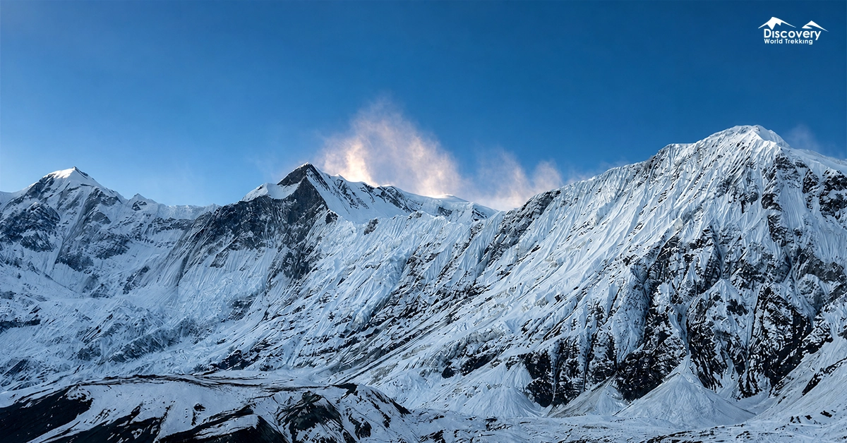
The Annapurna Circuit Trek in August offers a vibrant and refreshing Himalayan experience filled with green valleys, powerful waterfalls, peaceful trails, and dramatic mountain landscapes.
The lower sections come alive during the monsoon, while the higher regions around Manang and Mustang remain comparatively drier because of the rain-shadow effect.
With reliable waterproof gear, flexible planning, and careful attention to daily weather, August can be a rewarding time to experience the natural beauty and cultural richness of the Annapurna Circuit.
Is August a Good Time for the Annapurna Circuit Trek?
August can be a good time for the Annapurna Circuit if solitude, greenery, and cultural experiences matter more than consistently clear mountain views. It is not the most predictable month for completing the full circuit.
| Factor | August Conditions |
| Weather | Warm and humid below 2,500 metres; cooler and significantly drier around Manang and Mustang |
| Mountain views | Often blocked by morning or afternoon cloud, but temporarily clear after rainfall |
| Trail conditions | Muddy, slippery, overgrown, and leech-prone at lower elevations; firmer and drier beyond Pisang |
| Crowds | Very low compared with spring and autumn |
| Accommodation | Rooms are usually available, although some lodges operate with limited staff or menus |
| Thorong La Pass | Often crossable, but sleet, snow, fog, high wind, or poor visibility can occur |
| Difficulty | Moderate to strenuous because of rain, unstable ground, long descents, and elevations above 5,000 metres |
| Best for | Experienced trekkers seeking quiet trails, green landscapes, active waterfalls, and flexible travel |
Annapurna Circuit Weather in August
Annapurna Circuit weather in August changes dramatically with elevation and terrain. The lower Marsyangdi Valley experiences active monsoon conditions, while Manang and Mustang receive substantially less rainfall.
Temperatures generally decrease by about 6°C with every 1,000 metres of elevation gain. Actual conditions also depend on cloud, wind, rainfall, slope exposure, and the time of day.
The following figures are practical planning averages, not guaranteed forecasts.
Early August Weather
Early August is normally warm, humid, and actively influenced by the monsoon. Rain frequently falls overnight, in the afternoon, or during the evening, although full-day rain is possible.
Lower villages can feel hot while walking in waterproof clothing. Above Pisang, the air becomes cooler and less humid, but cloud may still hide the Annapurna peaks.
| Elevation level | Approx. average daytime temperature | Approx. average nighttime temperature |
| 800–1,500 m | 25°C–30°C | 19°C–22°C |
| 1,500–2,500 m | 20°C–25°C | 14°C–18°C |
| 2,500–3,500 m | 15°C–21°C | 9°C–14°C |
| 3,500–4,500 m | 9°C–16°C | 4°C–9°C |
| 4,500–5,416 m | 3°C–10°C | -2°C–4°C |
Mid-August Weather
Mid-August commonly remains unsettled, with alternating rain, mist, short sunny periods, and cloud build-up. A single monsoon system can produce several wet days, so departure times should be adjusted daily.
Manang may remain dry while lower access roads receive heavy rain. This difference can surprise trekkers who assume conditions are identical across the circuit.
| Elevation level | Approx. average daytime temperature | Approx. average nighttime temperature |
| 800–1,500 m | 24°C–29°C | 19°C–22°C |
| 1,500–2,500 m | 19°C–24°C | 14°C–18°C |
| 2,500–3,500 m | 15°C–20°C | 9°C–13°C |
| 3,500–4,500 m | 8°C–15°C | 3°C–8°C |
| 4,500–5,416 m | 2°C–9°C | -3°C–3°C |
Late August Weather
Late August can show brief signs of improvement, but the monsoon has not reliably ended. Some years bring longer sunny intervals, while others remain wet into September.
Nights become slightly cooler at high altitude. Fresh snow or sleet can occasionally affect Thorong High Camp and Thorong La, particularly during a strong weather system.
| Elevation level | Approx. average daytime temperature | Approx. average nighttime temperature |
| 800–1,500 m | 23°C–28°C | 18°C–21°C |
| 1,500–2,500 m | 18°C–23°C | 13°C–17°C |
| 2,500–3,500 m | 14°C–20°C | 8°C–13°C |
| 3,500–4,500 m | 7°C–14°C | 2°C–7°C |
| 4,500–5,416 m | 1°C–8°C | -4°C–2°C |
Average Temperature in August
Trail Conditions Along the Annapurna Circuit in August
Trail conditions improve as the route moves from the wet southern slopes into the rain-shadow valleys of Manang and Mustang.
Bhulbhule to Dharapani
This is usually the wettest and muddiest section of the August trek. Expect slick stone steps, swollen streams, active waterfalls, wet suspension bridges, and vegetation covering the edges of narrow paths.
Walk early because rain and river volume often increase later in the day. Do not cross moving water when its depth or riverbed cannot be judged safely. Leeches are common around shaded farmland and forest.
Dharapani to Chame
The trail remains damp but gains better drainage as elevation increases. Pine, fir, oak, and maple forests hold moisture, making roots, wooden bridges, and rock surfaces slippery.
Short rockfalls can occur beneath steep slopes after prolonged rain. Trekkers should avoid resting directly below exposed cliffs and allow extra distance between people when crossing loose sections.
Chame to Manang
The route becomes noticeably drier between Chame, Pisang, Ngawal, and Manang. Bhratang and the approach to Dhukur Pokhari may still be damp, but the valley gradually opens into a rain-shadow landscape.
The upper route through Ghyaru and Ngawal offers better acclimatization and wider views when clouds lift. It is also more exposed to wind and requires a sustained climb. The track may be firm while mountains remain hidden behind afternoon cloud.
Manang to Thorong High Camp
The trail is generally dry, cold, and exposed rather than muddy. From Manang to Yak Kharka and Ledar, the main concerns are altitude, wind, loose gravel, and animals using the narrow path.
Between Ledar and Thorong Phedi, move carefully across erosion-prone slopes. The climb from Thorong Phedi to High Camp is short but steep, gaining altitude rapidly when oxygen levels are already low.
Thorong La Pass
Thorong La remains the most weather-sensitive section of the circuit. August temperatures are milder than winter, but fog, sleet, fresh snow, frozen ground, and strong wind remain possible.
Muktinath to Jomsom and Beyond
Muktinath and Jomsom are comparatively dry, but afternoon wind can be strong. Dust, loose road surfaces, and passing vehicles may be more troublesome than rainfall.
Conditions change again south of Jomsom. Lete, Tatopani, Ghorepani, and the approach to Pokhara return to wetter monsoon terrain. Bus journeys may take longer because of road maintenance, landslides, or temporary closures.
Tilicho Lake in August
Tilicho Lake Trek remains a challenging monsoon adventure in August, although conditions may begin improving toward the end of the month.
Lower valleys are green and active with waterfalls, but rainfall can create muddy paths, landslides, transportation delays, and difficult river crossings. The ground may remain saturated even during short periods of sunshine.
The upper Manang Valley is relatively protected by the Annapurna rain shadow. However, cloud, rain, and unstable slopes can still affect the Tilicho trail.
Popular Festival in August
Yartung is the August festival most closely connected with the northern Annapurna Circuit. It is a traditional end-of-summer celebration associated with Mustang’s Tibetan Buddhist communities.
The festival commonly includes horse racing, local music, dancing, religious observances, community gatherings, and ceremonial dress.
The largest celebrations are normally associated with Upper Mustang, while smaller activities may occur around Muktinath and neighbouring settlements.
Dates follow local lunar calculations and should be reconfirmed before planning a trek around them.
Janai Purnima is another important August festival across Nepal. Families observe religious rituals and eat kwati, a soup prepared from sprouted beans. Trekkers starting or finishing in Kathmandu may notice temple gatherings, family travel, and reduced government services around the holiday.
Flora and Fauna Seen in August
August produces the greenest vegetation of the trekking year along the lower Annapurna Circuit.
Terraced farms contain maize, millet, rice, potatoes, buckwheat, beans, and seasonal vegetables, depending on elevation.
Between Bhulbhule and Chame, the forests appear dense and wet. Ferns, mosses, bamboo, oak, maple, pine, and broadleaf plants cover slopes that look much drier during autumn.
Rhododendron trees remain green, but their main flowering season has already passed.
Beyond Chame, the vegetation gradually changes to pine, juniper, seabuckthorn, alpine shrubs, and open grassland. Around Yak Kharka and Ledar, summer grazing areas support yaks, horses, sheep, and mules.
Possible wildlife sightings include:
- Himalayan monal and other forest birds around quieter wooded sections
- Lammergeiers, Himalayan griffons, and eagles above open valleys
- Blue sheep on rocky slopes above Manang
- Himalayan marmots and pikas near alpine grassland
- Langurs or barking deer in lower forest zones
Snow leopards inhabit the northern Annapurna region, but a trail sighting is extremely unlikely.
Wildlife should be observed quietly from a distance without feeding or approaching animals. The Annapurna Conservation Area supports more than 1,200 flowering plant species, 105 mammal species, and over 500 bird species.
Leeches are common on wet, vegetated paths below approximately 2,500 metres. They are unpleasant rather than dangerous, but bites should be cleaned to prevent infection.
Annapurna Circuit Packing List for August
An August packing list must manage rain, humidity, cold altitude, and slow drying conditions.
Clothing
- Lightweight waterproof shell with a reliable hood
- Waterproof overtrousers with side zips
- Two moisture-wicking trekking shirts
- Quick-drying trekking trousers
- Thermal base layer for High Camp
- Insulated jacket for mornings above Manang
- Warm hat, sun hat, and waterproof gloves
- Four pairs of trekking socks
- Dry clothes reserved for sleeping
Footwear and Trail Equipment
- Waterproof trekking boots with strong wet-surface grip
- Trekking poles for mud and steep descents
- Gaiters for rain, mud, and leech protection
- Backpack rain cover plus internal dry bags
- Headlamp with spare batteries
- Microspikes when recent snow is reported near Thorong La
Health and Personal Items
- Water purification filter or tablets
- Oral rehydration salts
- Personal medicines and a compact first-aid kit
- Blister dressings and antiseptic
- High-SPF sunscreen and lip balm
- Insect repellent
- Small quick-drying towel
- Power bank and waterproof electronics pouch
Cotton clothing should be avoided because it absorbs moisture and dries slowly. Pack important documents, cash, medicines, and sleeping clothes inside separate waterproof bags.
Safety Tips for Trekking in August
Safe August trekking depends on conservative decisions rather than speed.
- Begin walking early. Morning conditions are commonly more stable, and reaching the next lodge before afternoon rain reduces exposure.
- Check conditions locally every day. Lodge owners, guides, checkpoint staff, and mule handlers often know about damaged bridges or blocked paths before formal notices appear.
- Never enter a landslide section during active movement. Falling stones, muddy water, cracking sounds, and freshly disturbed soil indicate immediate danger.
- Descend when altitude symptoms worsen. Persistent headache, vomiting, confusion, poor coordination, unusual breathlessness, or inability to walk normally requires immediate action.
- Do not force Thorong La. A delayed or abandoned crossing is safer than entering fog, heavy precipitation, deep fresh snow, or extreme wind.
- Carry spare travel days. Keep at least two contingency days for road disruption, illness, weather delays, or a postponed pass crossing.
FAQs
Can beginners complete the Annapurna Circuit Trek in August?
August is not the easiest month for beginners. A fit beginner may complete it with a licensed guide, slow itinerary, acclimatization day, suitable gear, and flexible pass plans. Previous multi-day trekking experience is strongly preferable.
Does it rain throughout the Annapurna Circuit in August?
No, rainfall varies sharply across the route. The lower Marsyangdi Valley receives heavy monsoon rain, while Manang, Muktinath, and Jomsom are much drier because they lie behind the Annapurna mountain barrier.
Are mountain views available in August?
Mountain views are possible but unreliable. Short clear periods often occur after overnight rainfall or shortly after sunrise. Cloud usually increases as the day warms.
Plan Smarter, Trek Better
Connect with our local expert for honest recommendations, personalised guidance, and insider tips to make every step of your adventure count.

Get our free Nepal travel guide filled with expert insights, local tips, and essential planning advice.