

Annapurna Circuit Trek in July
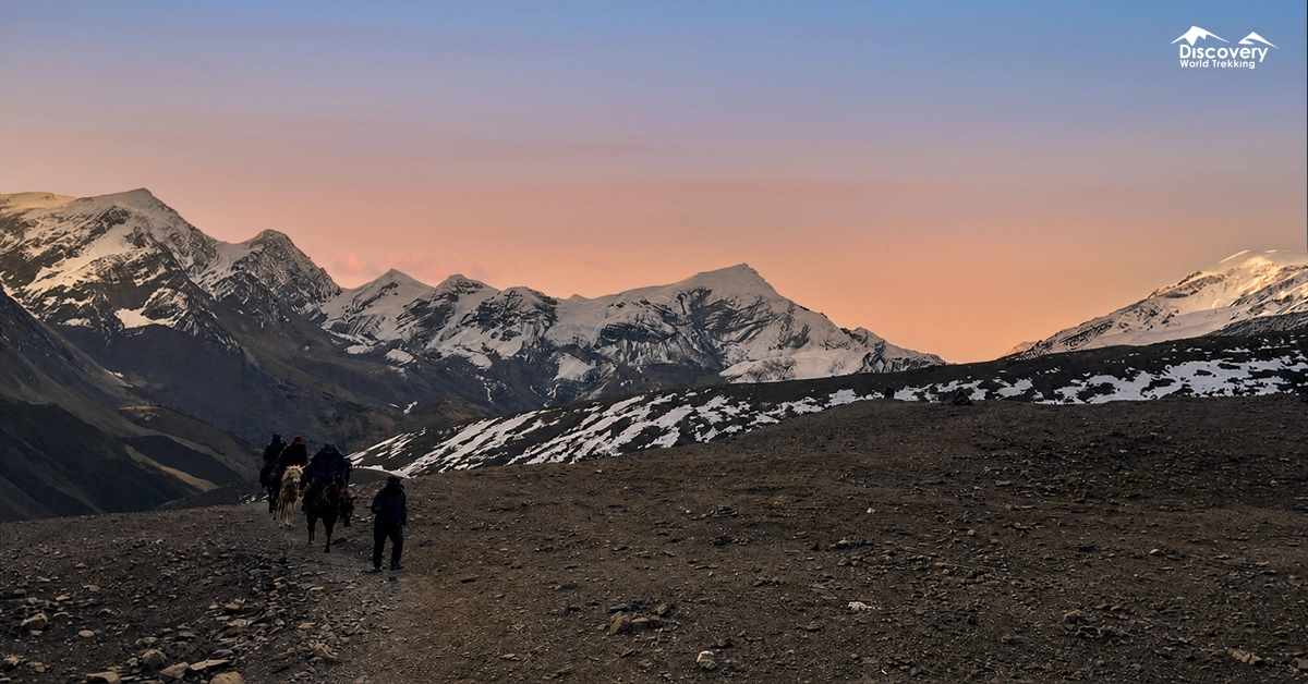
July is the wettest monsoon month in Nepal. So lower valleys receive frequent rain, muddy trails, swollen streams, and occasional transport disruption.
Conditions improve considerably after entering the trans-Himalayan rain shadow. Upper sections can remain surprisingly dry while areas south of the mountains receive heavy rainfall.
Is July a Good Time for the Annapurna Circuit Trek?
July is suitable for prepared trekkers who accept rain, limited views, and possible delays. It is not the best month for travellers with a tight schedule or little experience in wet mountain conditions.
July provides one of the quietest Annapurna Circuit experiences. Rooms are easier to find, trails feel peaceful, and villages are not shaped around peak-season trekking traffic.
However, fewer visitors may also mean reduced menus, smaller food stocks, and fewer staff at remote lodges. Calling ahead becomes useful around Thorong Phedi and High Camp.
| Factor | July Conditions |
| Weather | Warm and humid below 2,000 metres; cool and changeable above Manang; regular monsoon rain on southern slopes |
| Mountain views | Unpredictable; clearest shortly after sunrise or following a strong overnight shower |
| Trail conditions | Mud, wet stones, leeches, swollen streams, loose slopes, and occasional landslide damage |
| Crowds | Very low compared with spring and autumn |
| Accommodation | Usually available, although remote lodges may offer reduced menus or limited staffing |
| Thorong La Pass | Often crossable, but fresh snow, wind, cloud, or poor visibility may delay the crossing |
| Difficulty | High because rain, altitude, slippery terrain, and transport delays occur together |
| Best for | Experienced trekkers, slow travellers, monsoon photographers, and people with flexible schedules |
Annapurna Circuit Weather in July
July weather is warm in the lower valleys, cool in Manang, and potentially freezing around Thorong La. Elevation affects temperature, while the Himalayan rain shadow controls rainfall.
Early July Weather
Early July normally brings established monsoon conditions to the lower circuit. Rain often falls overnight, during the afternoon, or in several short bursts rather than continuously throughout the day.
Dry morning windows remain possible. Starting around 6:00 AM can provide cooler walking conditions and better visibility before clouds rise.
| Elevation level | Average daytime temperature | Average nighttime temperature |
| 800–1,900 m | 24–29°C | 18–22°C |
| 2,600–3,300 m | 16–22°C | 9–14°C |
| 3,500–4,200 m | 10–17°C | 3–9°C |
| 4,900–5,416 m | 0–7°C | -5 to 1°C |
Mid-July Weather
Mid-July usually brings active monsoon conditions, but rainfall remains uneven. Several wet days may be followed by a clear break lasting multiple days.
This variation matters when planning the pass. A dry lower valley does not confirm good conditions at Thorong La, and heavy rain near Dharapani does not mean Manang is equally wet.
Thunderstorms are possible on exposed ridges. Trekkers taking the upper trail through Ghyaru and Ngawal should avoid remaining on open slopes when thunder is nearby.
| Elevation level | Average daytime temperature | Average nighttime temperature |
| 800–1,900 m | 23–28°C | 18–22°C |
| 2,600–3,300 m | 15–21°C | 9–14°C |
| 3,500–4,200 m | 10–16°C | 3–8°C |
| 4,900–5,416 m | 0–6°C | -5 to 1°C |
Late July Weather
Late July remains fully within the monsoon, but it is not automatically wetter than mid-July. Rain depends on whether the monsoon is active or temporarily weak.
Temperatures change little across the month. Trail damage and river levels matter more than minor temperature differences.
| Elevation level | Average daytime temperature | Average nighttime temperature |
| 800–1,900 m | 23–29°C | 18–22°C |
| 2,600–3,300 m | 15–21°C | 9–14°C |
| 3,500–4,200 m | 10–16°C | 3–8°C |
| 4,900–5,416 m | 0–6°C | -5 to 1°C |
Average Temperature in July
Trail Conditions Along the Annapurna Circuit in July
July trail conditions improve gradually as the route moves north into the rain shadow. The wettest walking usually occurs before Chame and again after descending beyond Jomsom.
Bhulbhule to Dharapani
This is normally the wettest and most demanding monsoon section. Warm temperatures, dense vegetation, muddy tracks, and frequent water crossings shape each day.
The route follows river valleys through Ngadi, Bahundanda, Jagat, Chyamche, Tal, and Kodo. Several sections sit beneath steep road cuttings or cliffs, where prolonged rain can loosen stones and soil.
Stone steps become polished and slippery. Mud can hide unstable rocks, so every foot placement requires more attention than during the dry season.
Small streams can change quickly after overnight rainfall. A crossing that appeared easy the previous afternoon may carry stronger water the following morning.
Leeches are common around wet grass, forest edges, and muddy shortcuts. Wearing leech socks helps, but checking boots and trouser cuffs during breaks remains necessary.
Dharapani to Chame
This section is cooler but remains damp, cloudy, and slippery. The trail climbs through oak, maple, pine, and fir forest toward Timang and Chame.
Wet roots create a larger slipping risk than deep mud. Pine needles can also slide over smooth stone, especially during descents.
Mist may reduce visibility around forest junctions. A downloaded offline map is useful, but recent local instructions should take priority when landslides have forced temporary diversions.
Chame to Manang
The route becomes progressively drier between Chame and Manang. Rain remains possible, but the surrounding landscape begins showing the effects of the rain shadow.
The section around Bhratang and Dhukur Pokhari can remain wet. Beyond Pisang, trails are generally firmer, although exposed slopes may become slippery during storms.
The higher route through Ghyaru and Ngawal provides excellent acclimatization. It also involves a substantial climb and greater exposure to wind, lightning, and cloud.
Begin early and avoid committing to an open ridge during nearby thunder. Waiting in a village is safer than sheltering beneath an isolated tree or beside an exposed wall.
Manang to Thorong High Camp
This section is usually drier, but altitude replaces rain as the main difficulty. The landscape becomes open, rocky, windy, and increasingly cold.
The reference schedule travels from Manang to Ledar before reaching Thorong High Camp the following day. It also includes a full acclimatization day in Manang.
That schedule should not be compressed because rain delayed an earlier stage. High Camp stands at approximately 4,925 metres, where poor sleep, headache, reduced appetite, and breathlessness require careful monitoring.
Thorong La Pass
Thorong La may be crossable in July when local conditions are stable. The decision must be based on current reports from lodge operators, guides, and trekkers arriving from the opposite direction.
Cloud can reduce route visibility, while summer precipitation may fall as rain, sleet, or snow at pass level. Frozen ground is possible during the early morning.
Start before dawn only when the route and weather are considered safe. Darkness should not be used to compensate for poor navigation or uncertain trail conditions.
Muktinath to Jomsom and Beyond
Muktinath and Jomsom are among the driest sections of the July circuit. The route crosses open, eroded landscapes where wind and dust may replace rain.
Strong valley winds commonly develop later in the day. Early travel offers calmer conditions between Muktinath, Kagbeni, and Jomsom.
Conditions become wetter again beyond Jomsom toward Tatopani. The road passes through steep river valleys where landslides, rockfall, and vehicle delays become more likely.
Tilicho Lake in July
Trekking to Tilicho Lake in July is possible, but peak monsoon conditions make it one of the least predictable months for the trek.
Heavy rainfall can affect the lower Annapurna Circuit approach, causing landslides, road interruptions, muddy trails, and swollen rivers. Nepal receives most of its annual precipitation during the summer monsoon period from June through September.
Upper Manang is comparatively dry, but the narrow and exposed trail between Khangsar, Tilicho Base Camp, and the lake can still become slippery or unstable. Cloud and fog may also reduce visibility.
Streams crossing the trail can rise after rainfall, while loose rocks may fall from saturated slopes. Trekking beneath active landslide areas should be avoided.
July visitors should travel with an experienced guide, check forecasts and local reports daily, and maintain several flexible days. The lake trip should be cancelled during heavy rain, thunderstorms, landslide activity, or poor visibility.
Popular Festival in July
Sawane Sankranti and Nag Panchami are two important festivals that may fall during a July visit. Festival dates follow Nepal’s Bikram Sambat and lunar calendars, so their Gregorian dates should be checked each year.
Sawane Sankranti
Sawane Sankranti marks the beginning of the Nepali month of Shrawan.
People bathe, visit relatives, make offerings, and begin a month associated with worship of Shiva. Some communities maintain the luto phalne tradition, which symbolically removes illness and harmful influences after the muddy rice-planting season.
Women commonly wear green clothing, green bangles, and henna during Shrawan. These colours represent fertility, vegetation, prosperity, and the peak of the monsoon growing season.
Nag Panchami
Nag Panchami honours sacred serpents associated with water, rainfall, and protection.
Families place serpent images above doorways and make offerings of milk, flowers, grains, or incense. Trekkers may notice ceremonies around temples, springs, household courtyards, and water sources.
Flora and Fauna Seen in July
July produces the circuit’s densest vegetation and most active lower-elevation ecosystem. The forested route can appear completely different from its dry spring or autumn condition.
Moss covers stones, ferns spread beside streams, and wet slopes support nettles, bamboo, wild herbs, mushrooms, and broadleaf plants. Small seasonal flowers appear around field edges and forest clearings, while alpine grasslands develop above the tree line.
The main rhododendron season has finished. However, the forests remain colourful through new leaves, wet bark, ground plants, and flowering shrubs.
July is also active farming season. Trekkers may see maize growing around lower villages, rice cultivation in warmer valleys, potatoes at moderate elevations, and barley in drier settlements.
Bird activity is often noticeable after rain. Himalayan griffons and bearded vultures may appear above open valleys, while smaller forest birds remain active around damp woodland.
Pikas, marmots, and blue sheep may be seen in the alpine zone. Sightings are more likely during dry morning periods when animals leave shelter to feed.
Leeches are the most common animal encounter below roughly 2,500 metres. Frogs, insects, snails, and butterflies also become more active in wet environments.
The Annapurna Conservation Area supports 1,226 recorded flowering plant species, 105 mammal species, 523 bird species, 40 reptile species, and 23 amphibian species across its different climate zones.
Annapurna Circuit Packing List for July
July packing list must cover tropical rain, strong sun, cold wind, and freezing pass temperatures. A single heavy jacket cannot handle these different conditions effectively.
| Category | Essential items |
| Rain protection | Waterproof shell, rain trousers, backpack liner, dry bags, pack cover, gaiters |
| Trail clothing | Quick-drying shirts, trekking trousers, spare socks, light fleece |
| High-altitude clothing | Insulated jacket, thermal layers, warm hat, waterproof gloves |
| Footwear | Waterproof boots with reliable grip and camp sandals |
| Sleeping equipment | Sleeping bag rated around -10°C and a dry sleeping liner |
| Navigation | Offline map, headlamp, spare batteries, charged power bank |
| Health | Personal medicine, blister treatment, electrolytes, water purification |
| Sun protection | Sunglasses, SPF 50 sunscreen, lip balm, sun hat |
| Wet-season extras | Leech socks, insect repellent, small umbrella, quick-drying towel |
| Pass equipment | Trekking poles and lightweight traction after recent snowfall |
Safety Tips for Trekking in July
July safety depends on responding to current conditions rather than following fixed timings.
- Start early. Morning travel usually provides cooler temperatures, lower river levels, and better visibility.
- Ask about the next section daily. Lodge owners and people arriving from the opposite direction often know about fresh landslides or damaged bridges.
- Increase sleeping altitude slowly. Above 3,000 metres, the Himalayan Rescue Association advises limiting the sleeping-altitude increase to roughly 300–400 metres per day.
- Descend when symptoms worsen. Increasing headache, vomiting, poor coordination, confusion, or breathlessness at rest requires immediate action.
- Separate waterproof essentials. Keep medication, passport, cash, phone, headlamp, and emergency clothing in independent dry bags.
- Keep two buffer days. Landslides and road closures can affect the approach, the Jomsom–Tatopani section, or the return journey.
FAQs
Does it rain all day in July?
No, rain does not always continue throughout the day. Rain often falls overnight or during afternoon periods, although several continuously wet days remain possible.
Can beginners trek the Annapurna Circuit in July?
July is not ideal for inexperienced Himalayan trekkers. Beginners should travel with experienced support and avoid rigid travel schedules.
Will teahouses remain open?
Most established overnight villages retain some accommodation. Remote lodges may operate with fewer rooms, smaller menus, and limited staff.
Are mountain views possible?
Yes, clear mountain views can appear briefly after rain or around sunrise. Continuous panoramic visibility should not be expected.
What is the driest part of the circuit in July?
Jomsom, Muktinath, and parts of Manang are generally the driest major sections. Jomsom’s official July rainfall normal is only 46.8 millimetres.
Plan Smarter, Trek Better
Connect with our local expert for honest recommendations, personalised guidance, and insider tips to make every step of your adventure count.

Get our free Nepal travel guide filled with expert insights, local tips, and essential planning advice.