

Annapurna Circuit Trek in June
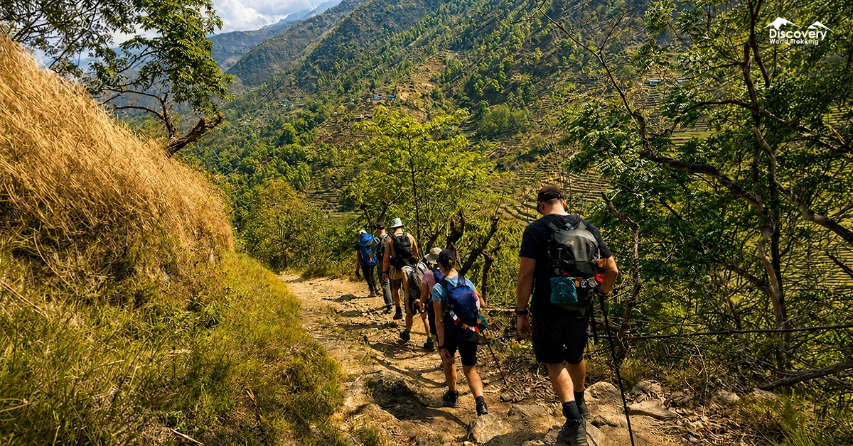
The Annapurna Circuit Trek in June is possible, but it requires flexible planning, reliable rain protection, careful acclimatization, and additional time for weather delays.
Early June often retains some pre-monsoon conditions, while rainfall usually becomes more frequent during the second half of the month.
June suits experienced trekkers who value green landscapes, quiet trails, and changing mountain weather more than guaranteed clear views.
Is June a Good Time for the Annapurna Circuit Trek?
June can be a good time for the Annapurna Circuit if fewer crowds and green landscapes matter more than stable weather.
It is not the best month for first-time Himalayan trekkers seeking consistently dry trails and uninterrupted mountain views.
The difference between the lower and upper circuit is important. Rainfall generally affects Bhulbhule, Jagat, Dharapani, and forested sections near Chame more heavily.
Conditions usually become drier after entering the Manang Valley, while Lower Mustang receives substantially less monsoon rainfall.
| Factor | June Conditions |
| Weather | Warm and humid below 2,000 metres; cool and changeable at higher elevations; frequent showers after the monsoon develops |
| Mountain views | Clearer during early mornings and after rainfall; clouds often build by late morning |
| Trail conditions | Muddy stones, wet roots, leeches and landslide exposure in lower valleys; drier but rocky trails beyond Manang |
| Crowds | Noticeably quieter than March–May and September–November |
| Accommodation | Rooms are usually easier to find, but lodge and menu choices may be limited in quieter settlements |
| Thorong La Pass | Often crossable, but recent snowfall, freezing conditions and strong wind can temporarily make the crossing unsafe |
| Difficulty | Challenging due to rain, slippery ground, altitude and uncertain transport |
| Best for | Experienced trekkers, photographers, slow travellers and people comfortable changing their schedule |
Annapurna Circuit Weather in June
June weather changes considerably with elevation and with the progress of the monsoon. Lower areas can feel hot and humid, Manang remains cool, and Thorong La can still experience freezing temperatures, fresh snow, and strong wind.
The following temperatures are practical planning ranges rather than daily forecasts. Local exposure, cloud cover, wind, rainfall, and recent snowfall can change the temperature by several degrees.
Early June Weather
Early June usually provides the month's most favourable trekking window. Pre-monsoon showers remain possible, but rainfall may be shorter and less persistent than later in the month.
Morning skies are often clearer, particularly in Manang and Mustang. Afternoon cloud, thunder, and brief rainfall can still develop, so starting early remains important.
| Elevation Level | Average Daytime Temperature | Average Nighttime Temperature |
| 800–1,900 m | 24–30°C | 16–20°C |
| 2,600–3,300 m | 16–22°C | 7–12°C |
| 3,500–4,200 m | 11–17°C | 2–7°C |
| 4,900–5,416 m | 1–8°C | -7 to -1°C |
Mid-June Weather
Mid-June is a transition period when rainfall usually becomes more frequent in the lower circuit. Nepal's historical monsoon onset varies significantly, so a trek beginning in mid-June may encounter either pre-monsoon showers or an established wet pattern.
Rain commonly develops during the afternoon or night. Several clear hours can still appear after sunrise, but clouds may hide the mountains before lunchtime.
| Elevation Level | Average Daytime Temperature | Average Nighttime Temperature |
| 800–1,900 m | 23–29°C | 17–21°C |
| 2,600–3,300 m | 15–21°C | 8–12°C |
| 3,500–4,200 m | 10–16°C | 3–8°C |
| 4,900–5,416 m | 1–7°C | -6 to 0°C |
Late June Weather
Late June normally brings the wettest and least predictable trekking conditions of the month. Longer rain spells can affect roads, trails, river crossings, and transport connections.
The contrast across the circuit becomes clearer during this period. Bhulbhule and Dharapani may receive regular rain, while Manang and Jomsom can remain comparatively dry because the Annapurna range blocks much of the moisture.
| Elevation Level | Average Daytime Temperature | Average Nighttime Temperature |
| 800–1,900 m | 22–28°C | 17–21°C |
| 2,600–3,300 m | 14–20°C | 8–13°C |
| 3,500–4,200 m | 9–15°C | 4–8°C |
| 4,900–5,416 m | 0–6°C | -5 to 1°C |
Average Temperature in June
Trail Conditions Along the Annapurna Circuit in June
Trail conditions improve as the route moves from the humid lower valley into the drier trans-Himalayan landscape. The most difficult monsoon sections are usually below Chame and on the post-Jomsom road toward Tatopani.
Bhulbhule to Dharapani
This is normally the wettest and most slippery section of the circuit in June. The route passes terraced farmland, waterfalls, riverside cliffs, suspension bridges, and warm forested valleys.
Stone steps become slick, unpaved road sections turn muddy, and small streams can grow quickly after overnight rain. Leeches are common around vegetation, particularly between Ngadi, Bahundanda, Jagat, and Tal.
Loose slopes near road cuttings deserve particular attention. Trekkers should never hurry beneath a slope where stones are actively falling, even when local traffic continues moving.
Dharapani to Chame
The trail remains damp but becomes cooler as it climbs through pine, fir, oak, and maple forest. Wet roots, pine needles, and moss-covered stones create more slipping hazards than deep mud.
Cloud often gathers around the forested ridges, reducing views from Timang. Clear breaks can still reveal Lamjung Himal, Annapurna II, and Annapurna IV.
Chame to Manang
Conditions become progressively drier between Chame and Manang. The route passes Bhratang, Dhukur Pokhari, Upper Pisang, Ghyaru, Ngawal, and Braga before reaching Manang.
Rain can still fall around Chame and Pisang, but the landscape opens and humidity decreases. The upper trail through Ghyaru and Ngawal offers better acclimatization and wider views, although it adds climbing and becomes exposed during thunderstorms.
Paungda Danda and the surrounding cliffs can produce strong wind gusts. Secure rain covers carefully because loosely fitted covers are easily torn or blown away.
Manang to Thorong High Camp
The trail above Manang is usually drier, colder and more exposed than the lower circuit. Mud becomes less important, while altitude, wind, loose rock, and cold nights become the main concerns.
The scheduled journey from Manang to Ledar gains roughly 670 metres, followed by a shorter but demanding climb through Thorong Phedi to High Camp.
Fresh snowfall is possible at any time around High Camp. Trekkers should ask lodge owners and guides about conditions before leaving Ledar rather than relying only on a phone weather application.
Thorong La Pass to Muktinath
The Thorong La Pass crossing can be completed in June when the weather is stable, but conditions must be assessed locally. An early departure reduces exposure to afternoon cloud, wind, and precipitation.
The ascent may include frozen ground, old snow, or short icy sections. The descent toward Muktinath is long and can be harder on the knees because it crosses loose gravel, dust, mud, and occasional snow. Trekking poles provide valuable stability on this descent.
Muktinath to Jomsom and Beyond
Muktinath and Jomsom are considerably drier than the eastern side of the circuit. The landscape changes to exposed slopes, eroded cliffs, dry riverbeds, and irrigated settlements.
Strong daytime wind is common in the Kali Gandaki Valley. Walking or travelling early generally provides calmer conditions, especially between Kagbeni and Jomsom.
Beyond Jomsom, the road toward Tatopani returns to wetter terrain. Landslides, rockfall, and delays become more likely as the route descends, so road conditions should be checked before leaving.
Tilicho Lake in June
You can do the Tilicho Lake Trek in June, but the trek becomes increasingly affected by the arrival of Nepal’s summer monsoon.
Early June may still provide useful trekking windows, particularly during clear mornings. As the month progresses, rainfall, cloud, and reduced mountain visibility become more common.
The Manang Valley receives less rainfall than many southern parts of the Annapurna region because of its position near the Himalayan rain shadow. However, the approach through the Marsyangdi Valley and exposed sections near Tilicho can still be affected by rain and unstable ground.
Wet rock, mud, small landslides, and swollen streams can slow the journey. Higher elevations may experience cold rain, sleet, or occasional fresh snow.
Most teahouses may remain available, but trekkers should confirm access conditions before leaving Manang. The trip should be delayed when continuous rain, poor visibility, or active slope movement affects the route.
Popular Festival in June
Ropain Diwas, or National Paddy Day, is the most relevant June celebration for trekkers travelling through Nepal's lower farming regions. It takes place on Asar 15 in the Nepali calendar, usually around June 29.
Families and farming communities gather in wet fields to transplant rice seedlings, sing traditional Asare songs, and share dahi chiura, a meal of curd and beaten rice.
Trekkers passing through lower-elevation settlements may see rice planting in terraced fields, although the scale of celebrations differs between villages.
Saga Dawa can also fall in May or June because it follows the Tibetan lunar calendar.
Buddhist communities observe the occasion through prayers, monastery visits, butter lamps, and acts of generosity, but its Gregorian date changes each year and should be confirmed before planning a trek around it.
Flora and Fauna Seen in June
June is one of the greenest periods on the Annapurna Circuit, particularly below the dry Manang plateau. Monsoon moisture covers the lower hillsides with ferns, grasses, moss, bamboo, nettles, and dense broadleaf vegetation.
The main rhododendron flowering period is largely over, but late blooms can remain at cooler elevations.
Pine, fir, oak, and maple forests dominate the climb between Dharapani and Chame, while juniper, dwarf shrubs, and alpine grasslands become more noticeable above Manang.
Around Yak Kharka and Ledar, short alpine plants emerge between rocks once seasonal snow retreats. These small flowers are easy to miss because many grow close to the ground to survive wind and cold.
Wildlife sightings depend on silence and timing. Himalayan griffons and bearded vultures may circle above open valleys, while pikas and marmot-like alpine rodents can appear near rocky slopes during sunny periods.
Blue sheep inhabit the northern high-altitude belt, but snow leopards are extremely unlikely to be seen despite the region being part of their habitat.
The Annapurna Conservation Area supports ecosystems ranging from subtropical forest to alpine meadow and trans-Himalayan cold desert.
Leeches are the wildlife trekkers are most likely to encounter below approximately 2,500 metres. They are common on wet vegetation, muddy shortcuts, and forest paths after rain.
Annapurna Circuit Packing List for June
A June packing list must handle both humid monsoon valleys and freezing high-altitude mornings.
Essential clothing and equipment include:
- A three-layer waterproof jacket with a hood
- Waterproof trousers with side zips
- Moisture-wicking shirts and trekking trousers
- A fleece or lightweight insulated mid-layer
- A warm down or synthetic jacket for High Camp
- Thermal base layers for sleeping and pass mornings
- Waterproof trekking boots with strong wet-surface grip
- Gaiters or leech socks for the lower valleys
- Three to four pairs of quick-drying trekking socks
- Warm gloves, a sun hat, and a wool or fleece cap
- Trekking poles with replaceable tips
- A backpack rain cover plus internal dry bags
- A sleeping bag suitable for approximately -10°C
- Water purification tablets or a reliable filter
- High-SPF sunscreen, lip protection, and sunglasses
- Insect repellent, blister treatment, and a personal medical kit
- Electrolyte powder and easy-to-eat energy snacks
- A headlamp with spare batteries
- A power bank kept inside a waterproof pouch
A rain cover alone does not keep a backpack dry during hours of heavy rain. Clothing, electronics, passport, cash, and sleeping gear should be packed in separate roll-top dry bags or heavy-duty waterproof liners.
An umbrella can be useful in lower villages and during light rain. It is unsafe and impractical on exposed ridges, in strong wind, or during lightning.
| 📄Ready to Pack for Your Annapurna Circuit Trip? Download Checklist |
Safety Tips for Trekking in June
- Start walking early. Lower trails are often quieter, cooler, and more stable before afternoon rain, while an early Thorong La departure reduces exposure to worsening wind and cloud.
- Do not ascend with worsening altitude symptoms. Persistent headache, nausea, unusual fatigue, poor coordination, or breathlessness at rest requires immediate assessment, rest, and potentially descent.
- Treat landslide zones seriously. Wait when rocks or mud are moving, avoid stopping beneath cut slopes, and never cross a flooded stream simply because footprints continue on the opposite bank.
- Keep electronics and emergency supplies waterproof. A wet phone, passport, headlamp, or medication can turn a manageable delay into a serious problem.
- Check bridges and temporary crossings after heavy rain. Water levels can change overnight, and familiar shortcuts may no longer be safe.
- Carry travel insurance that covers trekking above 5,416 metres and emergency helicopter evacuation. Confirm the maximum permitted altitude in writing rather than assuming "trekking cover" includes Thorong La.
- Use local information. Lodge owners, guides, porters, checkpoint staff, and people arriving from the opposite direction often know about recent snowfall, damaged trails, and road closures before online maps are updated.
FAQs
Does it rain all day on the Annapurna Circuit in June?
No, June rain does not necessarily continue all day. Many days include dry morning periods followed by afternoon or evening showers, although longer rain spells become more likely later in the month.
Which part of the Annapurna Circuit is driest in June?
Manang, Muktinath and Jomsom are generally the driest major sections. They lie in the trans-Himalayan rain-shadow zone, while Bhulbhule, Jagat, Dharapani and Tatopani receive substantially more monsoon moisture.
Are mountain views possible in June?
Yes, mountain views are possible, especially shortly after sunrise or immediately after rain. Clouds normally increase as the day warms, so viewpoints and photography walks should begin early.
Are leeches a problem in June?
Leeches are common on wet lower-elevation trails but are rarely a concern in dry alpine terrain. Long socks, gaiters and avoiding overgrown shortcuts reduce contact.
Is June suitable for beginner trekkers?
June is not the easiest month for a first Himalayan trek. Beginners should use a conservative itinerary, trek with experienced support and maintain flexible travel dates.

Annapurna Circuit Trek Weather
Annapurna Circuit Trek in May
Plan Smarter, Trek Better
Connect with our local expert for honest recommendations, personalised guidance, and insider tips to make every step of your adventure count.

Get our free Nepal travel guide filled with expert insights, local tips, and essential planning advice.