


Tilicho Lake
Table of Contents
Tilicho Lake (4,919 m) is a vast, turquoise glacial lake in Nepal’s Annapurna region, renowned as one of the world’s highest large lakes reachable on foot and a sacred site linked to the Ramayana.
Where Is Tilicho Lake Located?
Tilicho Lake lies in Manang District, Gandaki Province, within the Annapurna Conservation Area, about 55 km north-west of Pokhara (straight-line distance).
It occupies a high glacial basin on the north side of the Annapurna massif, fed by meltwater from surrounding peaks and glaciers.
| Province | Gandaki Province |
| District | Manang District |
| Region | Annapurna Conservation Area |
| Elevation | 4,919 m (16,138 ft) |
| Latitude | 28.690° N |
| Longitude | 83.853° E |
Tilicho Lake Base Camp
Tilicho Base Camp is the key staging point for the day hike to Tilicho Lake on the Annapurna Circuit side trip.
It lies in the upper Manang valley, above Khangsar and Shree Kharka, within the Annapurna Conservation Area, at an elevation of around 4,150 m (13,615 ft).
The “camp” is not a formal campsite but a small cluster of teahouses and yak pastures where trekkers spend the night before tackling the lake.
What Is the Size and Depth of Tilicho Lake?
Tilicho Lake stretches about 4 kilometres long and 1.2 kilometres wide, covering a surface area of roughly 4.8 square kilometres.
Its average depth is around 85 metres, a substantial volume of water for a lake sitting this close to 5,000 metres.
According to Nepal's Department of Hydrology and Meteorology, no aquatic organisms have been recorded in the lake, likely a result of both the altitude and the near-freezing temperatures the water holds year-round.
Why Is Tilicho Lake Popular?
Tilicho draws trekkers for a combination of rarity and reward.
It is one of the highest trekking-accessible lakes on Earth, set inside a ring of peaks that few other locations in the Annapurna region can match. Reaching it means stepping into genuinely raw, untouched terrain well beyond the last treeline.
It is also popular precisely because it is a detour, not a required stop. Trekkers who make the extra effort to reach it tend to treat the lake as the highlight of the entire Annapurna Circuit.
And its dual religious significance, sacred to both Hindus and Buddhists, adds a spiritual dimension that turns the trek into something closer to a pilgrimage for many who visit.
What Can You See From Tilicho Lake?
Tilicho Lake is surrounded by some of the highest mountains in the Annapurna region. On a clear day, the lake offers beautiful views of snow-covered peaks rising around its steep mountain basin.
| Mountain | Elevation | Notes |
| Tilicho Peak | 7,134 m (23,406 ft) | Rises above the lake to the north, making it one of the most prominent peaks in the surrounding landscape. |
| Nilgiri Himal (North, Central, South) | Up to 7,061 m (23,166 ft) | A three-summited range visible to the south and south-east of the lake. |
| Gangapurna | 7,455 m (24,459 ft) | Forms part of the high mountain scenery to the east and south-east of the lake. |
| Khangsar Kang (Roc Noir) | 7,485 m (24,557 ft) | Another prominent peak in the mountains east and south-east of the lake. |
| Annapurna II, III, IV | 7,525–7,937 m (24,688–26,040 ft) | Add to the wider mountain panorama and connect the view with the main Annapurna massif. |

How to Reach Tilicho Lake?
There is no road and no airstrip anywhere near Tilicho Lake. It is reached entirely on foot, usually as a side trip from Manang.
Route: Manang → Khangsar → Tilicho Base Camp → Tilicho Lake
From Manang, the trail follows the same path toward Khangsar used to reach Shree Kharka, climbing gently above the river, through forest, and across cultivated fields before reaching Khangsar.
Beyond Khangsar, the trail continues to Tilicho Base Camp, crossing a landslide-prone stretch of loose rock and exposed drops along the way, the most hazardous section of the whole route.
From Tilicho Base Camp, the trail climbs steeply through Bais Ghumti, a series of 22 zigzag turns. After this steep section, the trail becomes flatter as it crosses an open, often snow-covered area before reaching the lake.
The walk from Manang to Tilicho Base Camp takes around 7 to 9 hours, usually split across two days. The final climb from Base Camp to the lake and back takes a further 5 to 6 hours, typically done as an early-morning round trip.
Newer Alternatives
Helicopter tours from Pokhara or Kathmandu fly directly to Tilicho Lake for a same-day visit, typically allowing 15–30 minutes at the shore on shared flights and up to 45–60 minutes on private charters before returning.
This option is popular with Hindu pilgrims who cannot manage the trek physically, and helicopters are also used in the region for emergency evacuation when weather and altitude permit.
Cultural and Religious Significance of Tilicho Lake
For Hindus, Tilicho is identified as Kak Bhusundi Lake, a site named in the Ramayana where the sage Kak Bhusundi, in the form of a crow, is said to have first narrated the epic to Garuda, king of birds.
Some pilgrims regard Tilicho’s waters as spiritually purifying and visit the lake to pray and seek blessings, although the identification of Tilicho with Kak Bhusundi Lake is a religious tradition rather than a historically established fact.
For Buddhists, the lake is tied to Milarepa, one of Tibet's most revered yogis and poets, believed to have meditated on its shores. His presence is felt throughout the wider Manang Valley, and Tilicho is considered one of the most spiritually significant points in the region for Buddhist practitioners.
The villages along the approach trail, Chame, Pisang, Manang, and Khangsar, are home to Gurung and Thakali communities with strong Tibetan cultural roots, visible in the language, architecture, and religious practice found throughout the valley.
Festivals Celebrated at Tilicho Lake
Tilicho Lake doesn't have a fixed festival calendar of its own, since it sits well beyond any permanent settlement.
Its religious significance instead plays out through pilgrimage rather than scheduled celebration: Hindu devotees visit specifically to bathe or offer prayers at the lake, particularly during auspicious periods in the Hindu calendar, while Buddhist visitors often incorporate prayers and circumambulation around the lake into their journey.
Nearby Attractions
- Tilicho Base Camp: The main overnight stop before reaching the lake, surrounded by rugged mountain scenery. It is about 4 km from Tilicho Lake.
- Khangsar Village: A traditional Himalayan village known for its stone houses, Tibetan-influenced culture, and mountain views. It is about 12–15 km from Tilicho Lake by trail.
- Manang Village: A major settlement on the Annapurna Circuit, known for its Buddhist culture, monasteries, cafés, and mountain views. It is about 19–21 km from Tilicho Lake by trekking route.
- Gangapurna Lake: A turquoise glacial lake below Gangapurna Glacier, offering a scenic stop near Manang. It is about 20–23 km from Tilicho Lake by trail.
- Braga Monastery: An old Buddhist monastery built on a hillside near Manang, known for its traditional architecture and mountain views. It is about 20–22 km from Tilicho Lake by trail.
Best Time to Visit Tilicho Lake
Tilicho Lake can technically be reached during much of the year, but timing is especially important because the trail climbs to 4,919 metres and includes exposed, landslide-prone sections. The most reliable periods are spring, from March to May, and autumn, from late September to November.
Spring (March to May)
Spring brings relatively mild daytime temperatures, longer daylight hours, and improving trekking conditions.
The lower sections of the route may show blooming flowers, while the mountain views become clearer as the season progresses.
However, snow can remain near Tilicho Base Camp and the final approach to the lake, especially in March and early April, making the trail slippery and sometimes requiring microspikes or other traction.
Occasional rain and melting snow can also make sections of the trail muddy. Checking recent snow conditions with a local guide before leaving is more reliable than relying only on general seasonal advice.
Autumn (September to November)
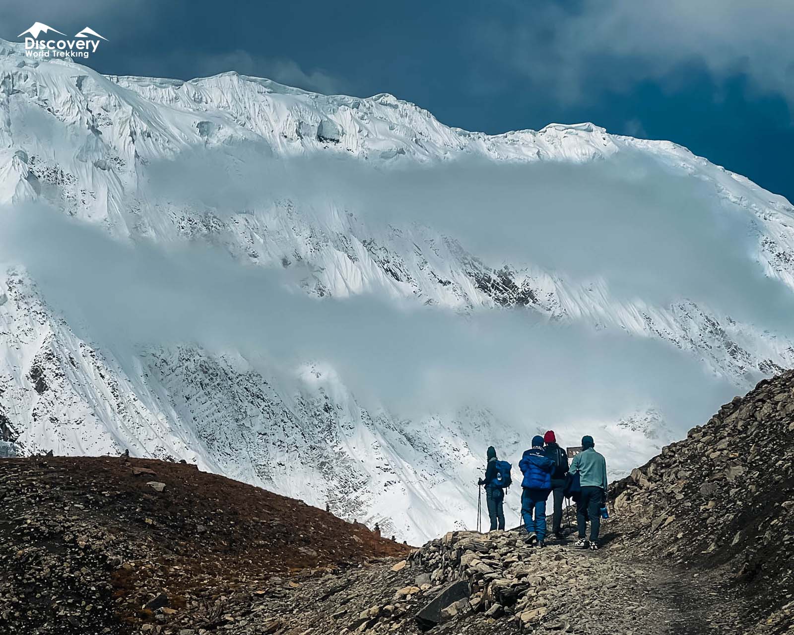
Autumn is generally the most dependable season to visit Tilicho Lake. After the monsoon, the skies usually become clear, visibility toward Annapurna and Tilicho Peak is excellent, and the trail is often drier and more stable.
October is usually the busiest month, so accommodation in Khangsar, Shree Kharka, and Tilicho Base Camp can fill quickly.
The main disadvantages are colder mornings and nights, higher prices in some places, and crowded trails during the peak season. Snow may also begin appearing at higher elevations in late November.
Winter (December to February)
Winter offers quiet trails, crisp mountain views, and a beautiful snow-covered landscape. However, temperatures at high altitude can fall well below freezing, and heavy snowfall may block the trail beyond Shree Kharka or Tilicho Base Camp.
Ice, snow, and avalanche risk can make the final approach dangerous, while some teahouses may close or provide only limited services.
This season is not recommended for inexperienced trekkers and should only be considered with proper winter equipment, current trail information, and an experienced guide.
Monsoon (June to August)
The monsoon season brings rain to the lower Annapurna Circuit, while the Tilicho area may experience cloud, poor visibility, and unstable trail conditions.
The landslide-prone sections between Shree Kharka, Khangsar, and Tilicho Base Camp can become slippery and hazardous when wet.
Mountain views are often hidden, and heavy rain may delay transport or alter the trekking route.
Although some experienced trekkers still visit during this period, monsoon is generally the least favourable time for Tilicho Lake because of landslides, leeches on lower trails, muddy paths, and limited visibility.
Temperature at Tilicho Lake
| Season | Daytime (at the lake) | Nighttime (Base Camp) |
| Spring (Mar–May) | 5°C to 10°C (41°F to 50°F) | -10°C to -5°C (14°F to 23°F) |
| Autumn (Sep–Nov) | 0°C to 5°C (32°F to 41°F) | -15°C to -10°C (5°F to 14°F) |
| Winter (Dec–Feb) | -10°C to -2°C (14°F to 28°F) | -20°C or colder (-4°F or colder) |
| Monsoon (Jun–Aug) | 5°C to 10°C (41°F to 50°F) | -3°C to 3°C (27°F to 37°F) |
How Difficult Is It to Reach Tilicho Lake?
Reaching Tilicho Lake is considered a moderate to challenging trek. It is not a technical mountaineering route. However, the high altitude, steep trails, exposed sections, changing weather, and long walking days make the journey physically demanding.
Main Challenges
High altitude:
Altitude is the greatest challenge on the Tilicho Lake trek. As the trail rises quickly, the reduced oxygen level can cause headaches, dizziness, nausea, tiredness, or shortness of breath. Spending time acclimatizing in Manang and walking at a steady pace can help reduce the risk of altitude sickness.
Steep final climb:
The trail from Tilicho Base Camp to the lake follows a long and demanding uphill route across rocky terrain. The climb becomes especially tiring because of the thin air and high elevation.
The journey to the lake and back is generally around 6–8 km, depending on the exact trail route and starting point.
Narrow and landslide-prone sections:
Some parts of the trail between Khangsar, Shree Kharka, and Tilicho Base Camp are narrow, exposed, and covered with loose rocks.
Rain, melting snow, or falling stones can make these sections more difficult, so trekkers should walk carefully and follow local safety advice.
Changing mountain weather:
Weather conditions can change quickly at high altitude. Strong winds, cloud, snow, cold temperatures, and reduced visibility may occur without much warning.
Poor weather can make the trail slippery and make it harder to see the route, particularly on the final approach to the lake.
Long walking days:
Trekkers should be prepared for walking approximately 5–8 hours on some days. The route includes uneven ground, steep ascents, and significant elevation gain, so a reasonable level of fitness is important.
Permits Required to Visit Tilicho Lake
Two permits are required, the same ones used across the rest of the Annapurna Circuit.
| Permit | Cost |
| Annapurna Conservation Area Permit (ACAP) | NPR 3,000 |
| TIMS Card (Trekkers' Information Management System) | NPR 2,000 |
Both permits are checked at multiple points, including Besisahar, Chame, and Manang, so carry printed copies rather than relying on digital versions in areas with limited signal.
Since April 2023, independent solo trekking without a licensed guide is no longer permitted in Nepal's conservation areas, so both permits are typically arranged through a registered trekking agency alongside a guide.
Where to Stay Near Tilicho Lake?
There is no accommodation at the lake itself. Trekkers stay at Tilicho Base Camp the night before and, often, the night after the summit push.
Base Camp teahouses are basic: You can find a few family-run teahouses offering basic twin rooms and dormitory-style beds. Shared toilets and bathrooms are available, while hot showers are limited and may cost extra.
Further back down the trail, Khangsar and Manang offer noticeably better facilities, including attached bathrooms and more reliable hot showers in some lodges, making them worthwhile stops to recover in after the trek.
Camping Near Tilicho Lake
Technically, tent camping near the lake shore is allowed, but it is rarely recommended for independent trekkers.
- No teahouses, food services, or proper toilet facilities at the lake itself.
- Extremely high altitude (4,919 m) increases the risk of altitude sickness if you sleep there without proper support.
- Camping makes sense mainly for organized groups with guides, cook staff, and full camping logistics.
For most visitors, the standard and safest approach is to sleep in Manang and Tilicho Base Camp, then day-hike to the lake and back.
What to Pack for Tilicho Lake?
- Trekking poles: Genuinely useful on both the landslide section and the steep climb to the lake.
- Layered clothing with a windproof, waterproof outer shell: Wind at the lake can exceed 60 km/h by afternoon.
- Sunglasses with strong UV protection: Glare off the snow-covered plateau near the lake is intense.
- Water and high-energy snacks: There's nothing to buy between Base Camp and the lake.
- Travel insurance covering helicopter evacuation: Emergency evacuations from this area can cost several thousand dollars, and without confirmed coverage, helicopters generally won't fly.
- Basic personal first-aid kit: Including altitude medication discussed with a doctor beforehand, since Shree Kharka sits well beyond easy access to medical facilities.
Comparison: Tilicho Lake vs Other High-Altitude Lakes
| Lake | Elevation | Location | Notes |
| Tilicho Lake | 4,919 m (16,138 ft) | Manang, Nepal | One of the highest large, trekking-accessible lakes in the world, reached via a demanding side trip from the Annapurna Circuit. |
| Kajin Sara Lake | 5,002 m (16,411 ft) | Chame, Manang, Nepal | Discovered in 2019, this is actually Nepal's highest lake, surpassing Tilicho, though far less visited and developed for trekking. |
| Gokyo Lakes (main lake) | ~4,750 m (15,584 ft) | Khumbu, Nepal | A six-lake glacial system in the Everest region, similarly sacred to Hindus and Buddhists, reached via Gokyo Valley. |
| Ice Lake (Kicho Tal) | 4,600 m (15,092 ft) | Manang, Nepal | A shorter day hike from Manang, often used as acclimatization before Tilicho or Thorong La. |
| Ojos del Salado crater lake | ~6,390 m (20,965 ft) | Chile–Argentina border, Andes | The genuine highest lake in the world, though not trekking-accessible in the way Himalayan lakes are. |
Is Tilicho Lake Worth It?
Yes, especially if you want to experience one of the most distinctive sections of the Annapurna Circuit.
The trail to Tilicho Lake takes you away from the main circuit and into a high, remote landscape surrounded by Annapurna peaks. Reaching the lake at 4,919 metres adds a real sense of achievement to the trek.
The journey is also rewarding for its changing scenery, from the dry slopes around Shree Kharka to the rugged trail above Tilicho Base Camp and the blue waters of the lake itself.
With proper acclimatization and preparation, Tilicho Lake is well worth adding to the Annapurna Circuit.
FAQs
What is the altitude of Tilicho Lake?
Tilicho Lake sits at 4,919 metres (16,138 feet) above sea level.
Is Tilicho Lake the highest lake in the world?
No. That title belongs to Ojos del Salado, a crater lake in the Andes at roughly 6,390 metres. Tilicho isn't even Nepal's highest lake anymore, Kajin Sara Lake in nearby Chame, discovered in 2019, sits higher at 5,002 metres. Tilicho remains one of the highest lakes in the world that's reachable on foot, which is where its reputation genuinely holds up.
Can you take a helicopter to Tilicho Lake?
Yes. Helicopter tours from Pokhara or Kathmandu fly directly to the lake, typically allowing 30 to 60 minutes at the shore before returning the same day. This option is popular with pilgrims who can't manage the trek physically.
Can beginners do the Tilicho Lake trek?
Yes, with proper preparation. The trail isn't technical, but it does demand real fitness, careful acclimatization, and respect for the landslide-prone section and the altitude. Fit beginners who prepare well generally complete it without serious difficulty.
Plan Smarter, Trek Better
Connect with our local expert for honest recommendations, personalised guidance, and insider tips to make every step of your adventure count.

Get our free Nepal travel guide filled with expert insights, local tips, and essential planning advice.